
English| EUR
Suggested for you
More currencies
Choose a language
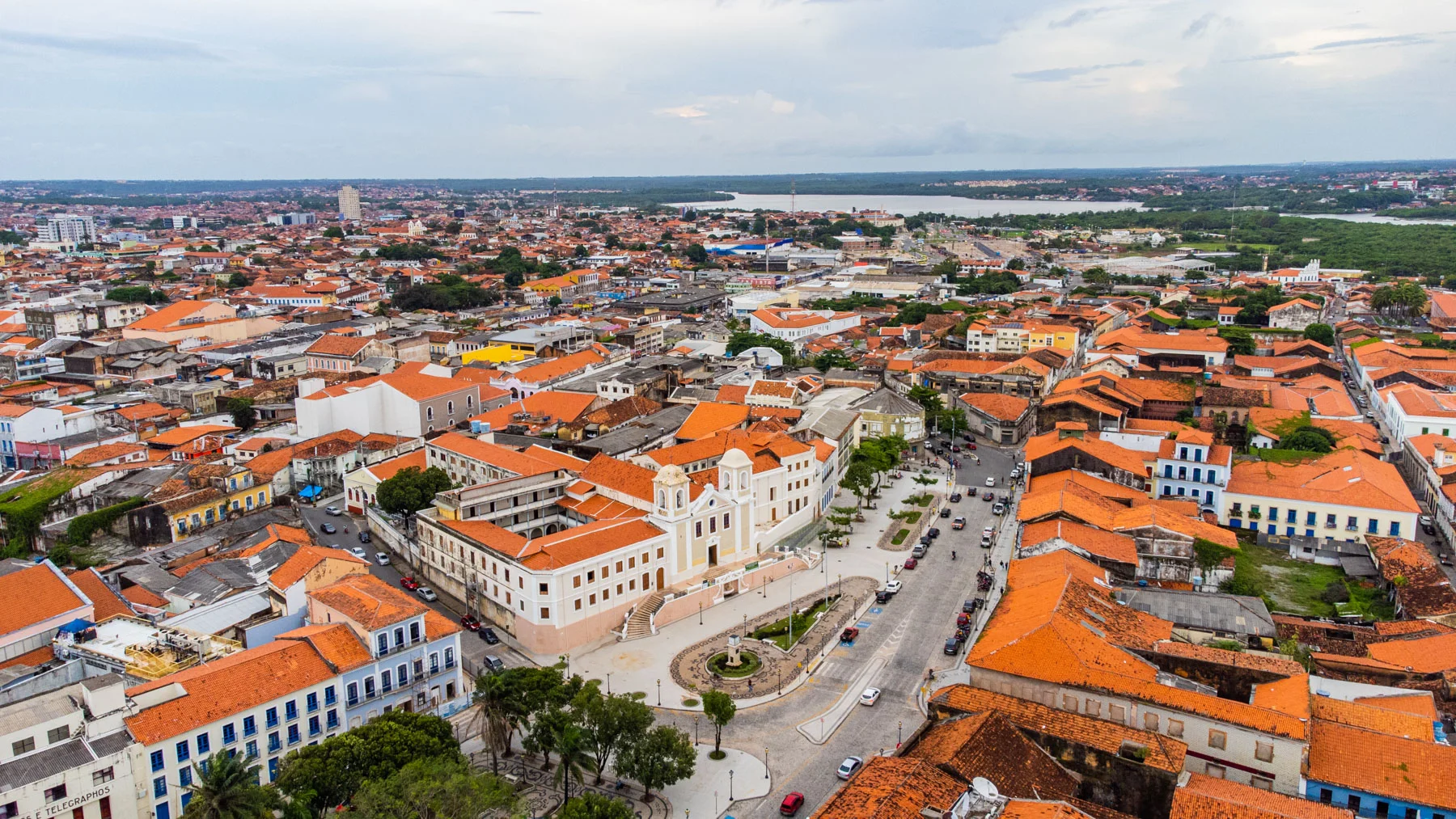
São Luís sits on São Luís Island in northeastern Brazil, the only state capital founded by the French and the primary gateway to Lençóis Maranhenses National Park. Understanding where São Luís is in Brazil clarifies why every visitor to the dunes passes through this UNESCO-listed colonial port city.
Quick answer
São Luís is the capital of Maranhão state in northeastern Brazil, positioned on the Atlantic coast at 2°31'S, 44°18'W. The city occupies São Luís Island where the Bacanga and Anil rivers meet the ocean, approximately 260 kilometers northwest of Lençóis Maranhenses National Park. Direct flights connect São Luís to major Brazilian cities, and the drive to Barreirinhas—the park's main access town—takes four hours via BR-135 and MA-402.
São Luís is the only Brazilian state capital located entirely on an island, a geographic peculiarity that shaped its role as a deepwater port and colonial crossroads. The city lies in the equatorial zone of Brazil's northeast shoulder, where the coastline bends sharply from north-south to east-west orientation. This position places São Luís 2,400 kilometers from Rio de Janeiro and 1,600 kilometers from Recife, closer to French Guiana than to São Paulo. When travelers ask where is Sao Luis in Brazil, they are often tracing the logistics of reaching Lençóis Maranhenses. The city functions as the region's air hub, with Marechal Cunha Machado International Airport receiving daily flights from Brasília, São Paulo, and Fortaleza. From the terminal, the route to Barreirinhas runs south on BR-135 through the municipality of Rosário, then east on MA-402 past the settlements of Morros and Primeira Cruz. The highway crosses flatland punctuated by babaçu palm groves and seasonal wetlands, the topography shifting from coastal plain to the sandstone escarpments that frame the dune field. São Luís itself is split between the historic center—a grid of Portuguese azulejo-tiled façades on the island's northern shore—and the modern districts of Renascença and Calhau that sprawl along the eastern beaches. The Maranhão landscape surrounding the capital is defined by mangrove estuaries, tidal deltas, and the meeting of the Amazon basin's eastern edge with the semi-arid caatinga. This ecological transition zone explains the presence of both rainforest species and drought-adapted flora within a single state. The colonial port district, inscribed as a World Heritage Site in 1997, occupies a low promontory above the Bacanga River mouth. Narrow streets follow the original French street plan of 1612, though the Portuguese expelled the founders within three years and rebuilt the settlement under Iberian grid logic. The tile work and iron balconies date primarily to the nineteenth-century cotton boom, when Maranhão supplied European mills and São Luís ranked among South America's wealthiest cities. That architectural layer remains intact across five hundred blocks, a density of preservation rare in tropical port cities. Visitors arriving in Maranhão state to explore the lagoons and dunes typically spend one night in São Luís before transferring to Barreirinhas, though the capital warrants longer attention for its reggae tradition, Bumba Meu Boi folklore cycle, and the concentration of colonial civic architecture along Rua Portugal and Rua do Giz. The city's position as a regional hub means all overland routes to Lençóis Maranhenses converge here, making it both the practical answer to where is Sao Luis in Brazil and the logistical threshold every dune-bound traveler crosses.
“São Luís is the only Brazilian state capital located entirely on an island, a geographic peculiarity that shaped its role as a deepwater port and colonial crossroads.”
São Luís is the capital city of Maranhão state in northeastern Brazil, serving as the primary air and land gateway for travelers visiting Lençóis Maranhenses National Park. The standard route to reach the park involves traveling southeast from São Luís to the town of Barreirinhas, which acts as the main base for park excursions.
Follow MA-204 and BR-135 to reach MA-402
Depart from São Luís Terminal Rodoviário to Barreirinhas
Direct transfer from São Luís Airport to Barreirinhas
For the best experience, aim for the best arrival window of 06:00–10:00. Arriving during this period helps you avoid peak heat and ensures optimal lighting for dune photography.
The period between June and September offers the most favorable conditions for visiting Lençóis Maranhenses, as the lagoons are filled from seasonal rains. For the best daily experience, visitors should plan to arrive within the best arrival window of 06:00–10:00 to manage heat and light.
High water levels, 28°C to 30°C
Lagoon water levels are at their peak during these months. Visitors can expect clear skies and warm temperatures.
Drier landscape, 30°C to 32°C
Lagoons begin to recede as the dry season progresses. This period offers quieter trails and lower visitor density.
—
Early arrival at 06:00 avoids peak heat and provides the best lighting for dune photography.
Verdict: The best time to visit is during the weekdays between June and August, arriving at the gates during the 06:00–10:00 window.
Lençóis Maranhenses National Park operates on a consistent daily schedule throughout the week. Visitors should plan their arrival within the established hours of operation.
Access to Lençóis Maranhenses National Park does not require an admission fee. Travelers should account for separate costs regarding transportation, local vehicle permits, or guided tours.
Verdict: A typical adult pays 0 BRL for park entry, with total costs depending on the specific tour or transport provider selected for logistics.
This itinerary suits travelers making the journey from São Luís through Barreirinhas to the park's main lagoon circuit. Plan for a full day including four hours of transfer time and at least three hours exploring the dunes.
Leave early to reach Barreirinhas by mid-morning, covering roughly 260 kilometers via BR-135 and MA-402. Stop briefly in Barreirinhas for supplies or to arrange a local guide.
Drive from Barreirinhas to the park entrance at Lagoa Bonita or Lagoa Azul, where vehicle permits are checked. The park opens at 06:00, but mid-morning arrivals still offer strong light for photography.
Walk twenty to thirty minutes across sand dunes to reach the seasonal freshwater lagoons. Water levels peak from June to September, when the lagoons are deepest.
Wade into the clear turquoise pools and explore the surrounding white dunes. Bring sun protection; shade is nonexistent on the open sand.
Retrace your route to Barreirinhas or continue onward if staying overnight. The park closes at 18:00, so departures after 15:30 risk a rushed exit.
Confirm these logistics before traveling from São Luís to the dunes.
Everything you need to know about where is sao luis in brazil
São Luís is the capital city of the state of Maranhão in northeastern Brazil and serves as the primary gateway for travelers visiting the dunes. Once you understand where is sao luis in brazil, you can coordinate your land transfer to Barreirinhas, which is the main hub for park access. Travelers often search for where is sao luis in brazil to map out their journey across the vast landscape of the Maranhão region. The national park does not charge an entrance fee, though visitors should budget for guided tours and authorized vehicle permits. You can access the area daily between 06:00 and 18:00 to explore the unique ecosystem. Arriving between 06:00 and 10:00 is recommended to avoid peak heat and to ensure optimal lighting for photography. While São Luís is a significant cultural landmark and a UNESCO World Heritage site, it is separated from the park by a multi-hour drive, making pre-arranged transfers essential for a smooth visit. The region features a tropical climate, so verifying local logistics is recommended regardless of where is sao luis in brazil on your map.